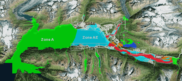
CLICK HERE for the map of proposed changes
The Federal Emergency Management Agency (FEMA) and the State of Alaska Department of Commerce, Community, and Economic Development will host a public meeting on Thursday, April 6, 2017 at 6:00 p.m. in the Valdez Civic Center to discuss draft FEMA flood map revisions for Valdez and explain what these revisions mean for property owners.
With advanced technology and better data, FEMA, in partnership with the State of Alaska Department of Commerce, Community, and Economic Development, recently issued preliminary flood maps for properties in Valdez. These revised maps depict the current risk of a